A practical guide to bird watching in Sonoma County, California
(Unless otherwise indicated, all phone numbers are in the 707 area code)
A practical guide to bird watching in Sonoma County, California
(Unless otherwise indicated, all phone numbers are in the 707 area code)

Sugarloaf Ridge State Park, Kenwood CA 95452
Location aliases: Generally known by its proper name. Sometimes referred to as Sugarloaf State Park, Sugarloaf Ridge, or just Sugarloaf.
Location: Sugarloaf Ridge State Park, Kenwood CA 95452
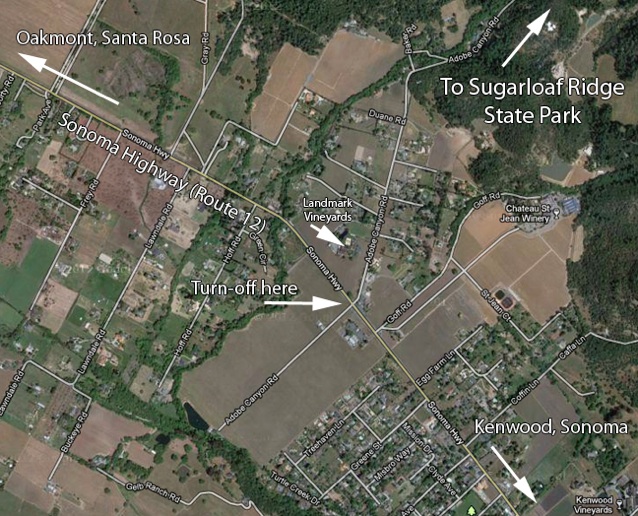
GPS address: 8400 Sonoma Highway (which is Highway 12) will take you approximately to the intersection of the highway and the turn at Adobe Canyon Rd., while 2605 Adobe Canyon Rd. is the address of Robert Ferguson Observatory. This second address is beyond the State Park parking area, but setting your GPS to this address will get you to the parking area.
GPS Coordinates: The main parking area is at 38.4379N, 122.5143W, or 38 26 17N, 122 30 52W
Access: Approached from Highway 12 by way of Adobe Canyon Rd. Note that Adobe Canyon Rd. becomes Mountain Trails Lane and then McCormick Lane. The upper parking area gives access to a number of good hiking trails excellent for birding. There is an $8 parking fee to enter the park. Call 833-5812 for updated information.
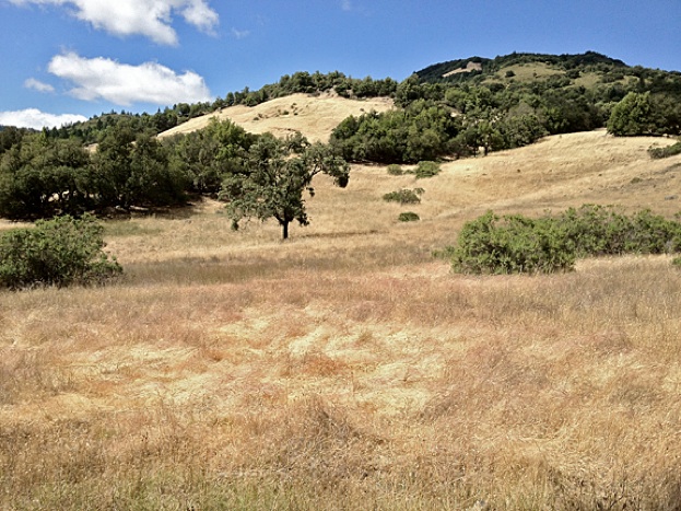
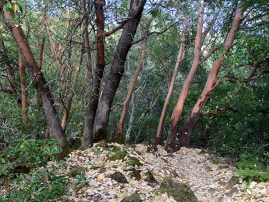
Habitats: Open scrub, meadows, wooded hills, riparian woods, mature deciduous and conifer forest
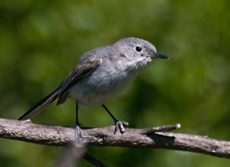
Unusual birds, sightings: Bell’s Sparrow (Doug Shaw, 4/15/15); Townsend’s Solitaire (1/31/13, Gene Hunn); Rufous-crowned Sparrow (5/12/12, Robert Jackson); California Thrasher (5/12/12, Robert Jackson); Northern Pygmy Owl (3/3/11, Gene Hunn); Northern Pygmy Owl (9/9/11, Ruth Rudesill); Pileated Woodpecker (2/2/10, Colin Talcroft). Abundance of Blue-gray Gnatcatchers (5/6/10, Colin Talcroft)
Restroom facilities: Toilets at the upper parking area.
Restaurants nearby: Café Citti, at 9049 Sonoma Highway (Hwy. 12; 833-2690) is probably the closest. It offers excellent salads, pastas, and other Italian food. Also see restaurant recommendations for the town of Sonoma below.
Related bird watching spots: Channel Dr., Spring Lake Park, Lake Ralphine, and Melita Rd. (all Santa Rosa) are in the vicinity. See individual location pages for details. If pressed for time, head for Spring Lake first among these choices.
Notes: 1. The trail that heads out to the right from the parking area (the “Meadow Trail”) will take you mostly through open meadows and streamside habitats. The “Bald Mountain Trail” leading off from the left of the parking area will take you into higher elevations with more wooded habitats, as will the "Vista Trail," which also affords excellent views. See the Sugarloaf Ridge State Park Website for more information. 2. Watch out for poison oak in wooded areas here (and throughout the county). 3. Note that this is one of several state parks that have been hit by the California state budget crisis. Officially closed, the park is now being operated for the time being by volunteers from a group of non-profits. Check the website for current information.
The bird in the photo: Blue-gray Gnatcatcher, Sugarloaf Ridge State Park, May 6, 2010
All photos by the author, unless otherwise indicated
Maps by Google Maps
© Colin Talcroft, 2009, 2010, 2011, 2012
Unless noted, all photos by the author. If you would like to use one of my images, please ask for permission for non-commercial use with proper credit or commercial use with proper compensation.